|
|
|
|
Archive of news
|
|
Batch orthophoto processing functions in Delta/Triada software
|
|
|
|
The new functions added to GED program allows to create orthophoto on whole area of a triangulation block. After block adjustment in Triada it can be inserted to GED and arranged with desired overlay. Then program automatically fits fragment radiometry during block transformation to create seamless mosaic.
 Download
Batch orthophoto step-by-step instruction
Download
Batch orthophoto step-by-step instruction
|
|
DPS software release includes triangulation measurements program
|
|
|
|
The software requires hard-lock key from now.
It works as demo-evaluation version without hard-lock.
Please visit Download page to obtain the latest
version, which includes the triangulation block preparation and automatic
measurements program.
Triangulation measurement program provides full on-line control during the
operation.
The
new version supports easy Internet update.
Just go to Help|About in main menu of GED or Triada and click Download
Update button
|
|
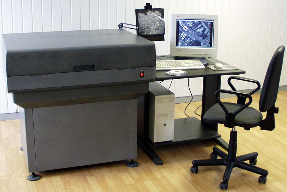
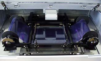
New scanner model for 300x450 mm images |
|
|
|
New
model is available on the beginning of 2001.
All scanners from now equipped with new PCI-interface card of video-processor,
which is significantly increases performance. Typical
scanning times for different pixels are indicated in Hardware
section.
Scanning software now supports scanning to JPEG compressed TIFF (version 6.0).
|
|
ISPRS 2000, XIX Congress, Amsterdam, The Netherlands, July 16-23
|
|
|
|
After
the exhibition we have new partners and distributors
in different countries.
See photos from the exhibition.
|
|
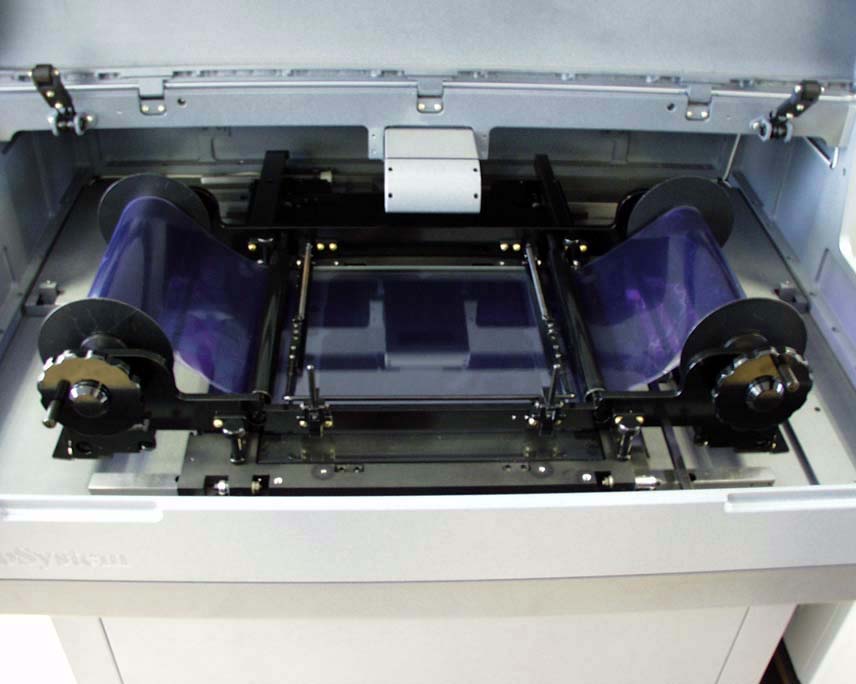
Enhanced design of the photogrammetric scanners.
|
|
|
|
In
the second quarter of 2000 the new models with enhanced design become available
|
|
|
The scanner is based on new mechanical basis with enhanced stability.
Improved servo-system which uses digital tachometers instead analogical and stricter movement system.
The scanner equipped by color CCD-line with 8µm resolution
Scanner technical specification
Scanning software features
|
|
|
|
The scanner uses 16bit servo-controller which have more reliable operation in multitasking environment.
The scanner has more convenient photo-holder and roll-film unit.
|
|
|
Digital photogrammetric software improvements. Digitals 5.0
|
|
|
|
The new version of DPS
Delta/Digitals mapping software is available since December of 1999.
Shutter stereo-glasses support (for ASUS V3800 UltraDeluxe video card);
Improved automatic DEM extraction and grid editing;
Enhanced raster correction;
Relief functions;
Semiautomatic relief extraction;
The Mono plus mode;
Multiple files viewing/operating in DIPView;
DXF+DBF output;
Printing and saving to BMP vector-raster orthophoto maps;
Automatic splitting on map sheets;
Favorite layers panel;
See DPS «Delta» software features
|
|
|
Improved radiometry of the photogrammetric scanners
|
|
|
|
Since September of 1999 Geosystem started production of color photogrammetric scanners with an enhanced 12/8bit video-controller.
|
|
It provides 12 bit (4096 levels) internal intensity resolution for each color channel and supports hardware lookup tables to external 8bit (256 levels).
This feature allows performing radiometric correction of an image without a quality reduction. It guaranties the correct and continuous density distribution on a scanned image ever for poor quality photo-materials.
The scanning density range has now been extended up to 2.7D and film fog density can reach 1D, thus maximum density of an image can reach 3.7D
The video system allows separate adjustment of exposition, contrast and gamma correction for each color channel.
|
 |
|
|
|
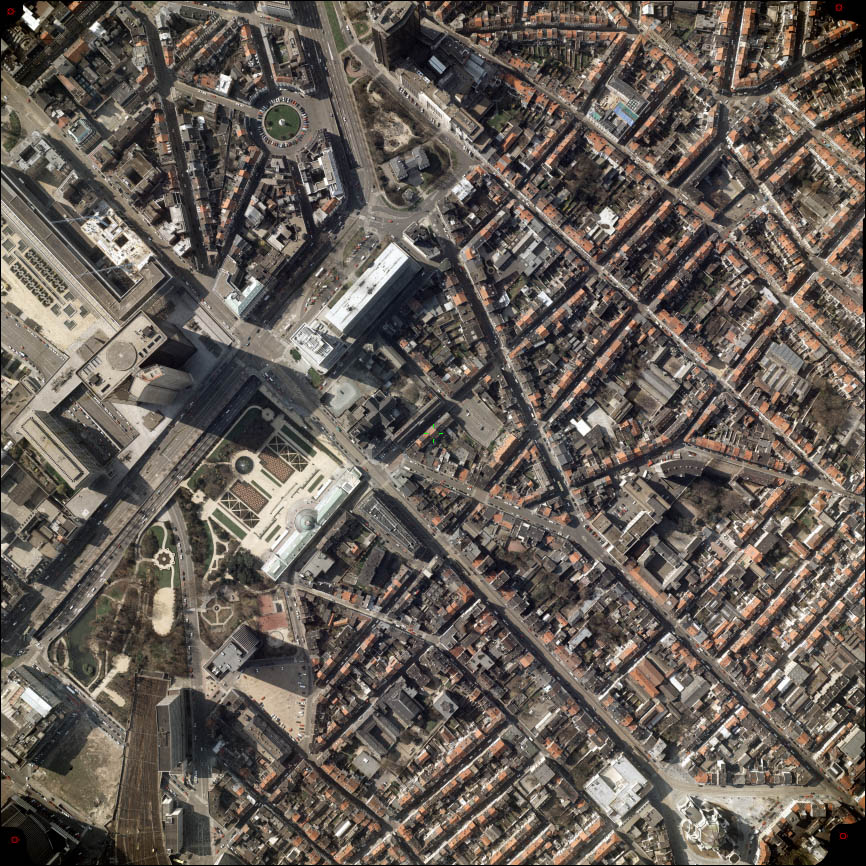
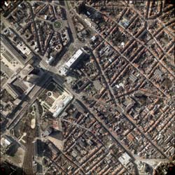
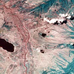
Low resolution image samples: aerial 1:5000 and satellite falsecolor..
|
After prescan process and construction of histograms, scanner software automatically offers optimum parameters of scanning (exposition, contrast and gamma on each color channel) for best fitting of the histograms to output scale of the scanner. The user has a possibility of manual set-up of the parameters by simple clicking on the luminosity histogram or histogram of any color channel. The software reflects the influence of all modifications immediately on the screen image.
The improvements did not affect the scanner performance.
|
|