Русский    Español       Home  Map   E-mail  
Digital Camera (Airborne Scanner) «3-DAS»
Digital Photogrammetric Station «Delta»
Color Photogrammetric Scanner «DeltaScan»
DPS «Delta» Software
Mapping and cartography
software «Digitals»
Photogrammetric Scanner software
Download
software...
        About us     News     Dealers : Digital Airborne Scanner

Digital Camera (Airborne Scanner) «3-DAS-1»

High resolution trilinear pushbroom airborne scanner with true RGB forward-nadir-backward channels

Download brochure

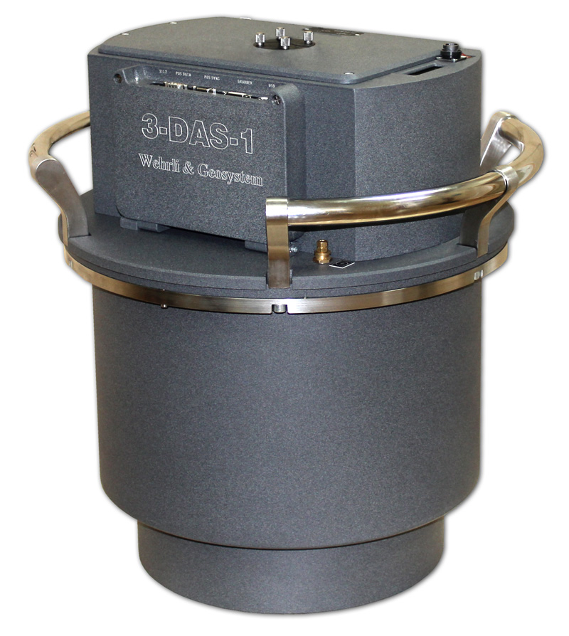
Features and benefits

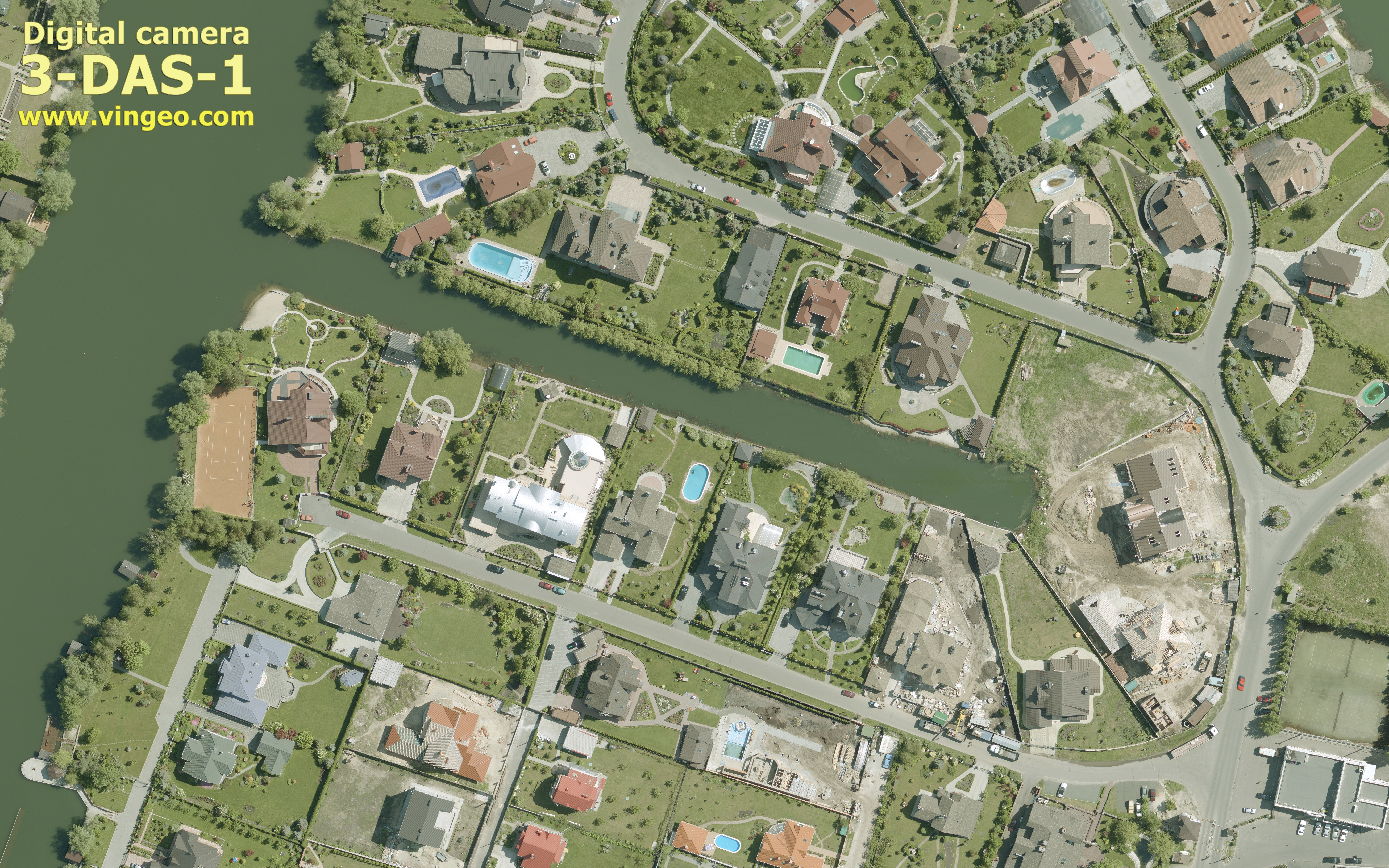
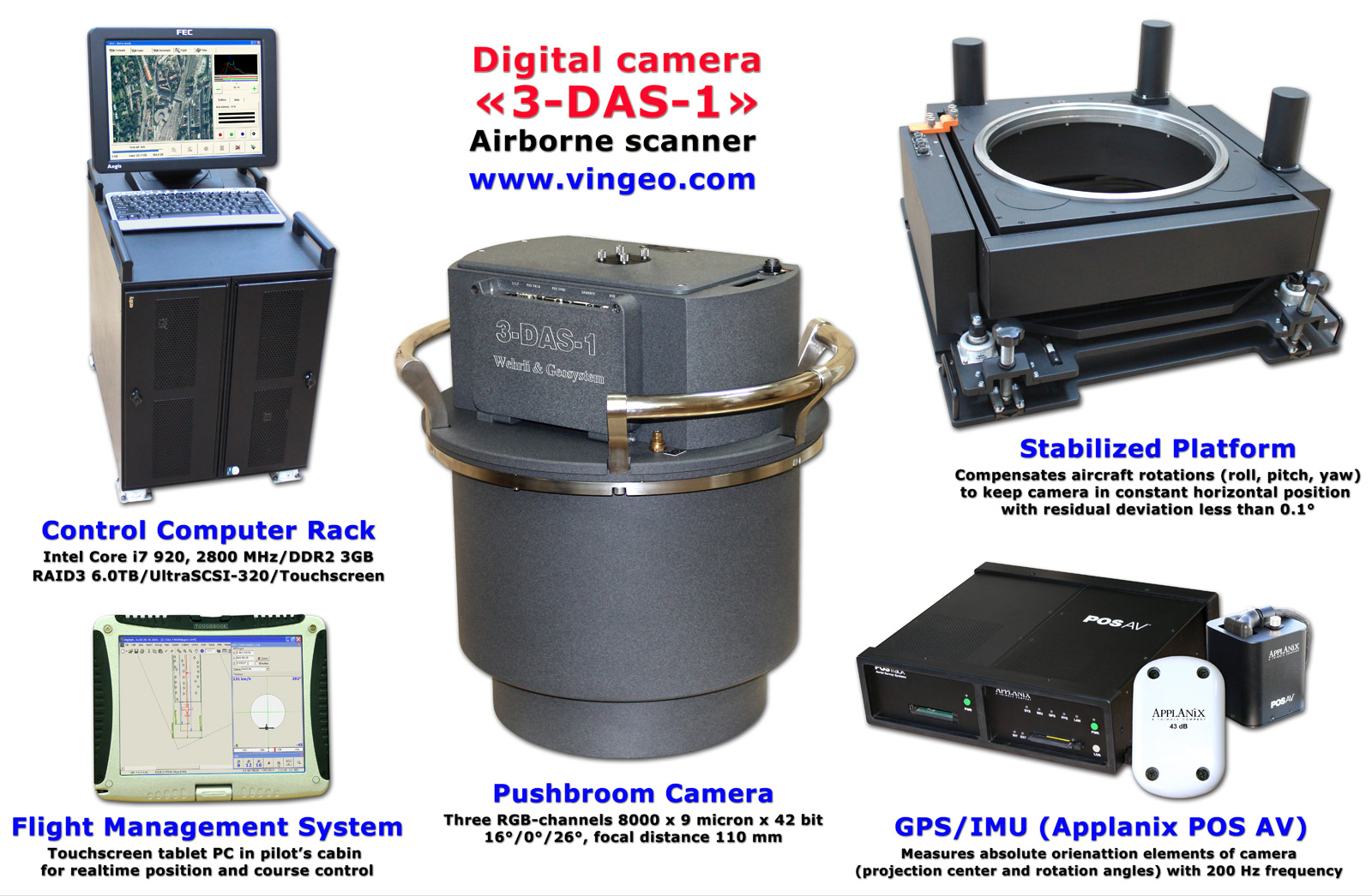
Complete digital photogrammetric workflow without film development, scanning, etc.

Contiguous seamless images for whole strip with permanent triple overlay.

Three RGB-sensors from Kodak provide crystal bright 42-bit images.

Realtime Image view and automatic selection of optimal exposition during the flight.

Unlimited flight capture time with hot swap RAID storage units.

On-the-fly lossless compression allows up to 16 hours of capture per terrabyte.

Selectable stereo for 3D-mapping with 16°, 26° or 42° convergence angle.

Simple and robust design for easy maintenance.

See also

Answers to frequently asked questions about «3-DAS-1»

Conclusion of Ukrainian scientific research institute of geodesy and cartography

Image samples

Flight project sample (GSD 0.09 m, 4 strips, stereo)

Ground sample distance 0.07 m (flight scale 1:8000)

Ground sample distance 0.11 m (flight scale 1:12000)

Ground sample distance 0.14 m (flight scale 1:15000)

Ground sample distance 0.23 m (flight scale 1:25000)

Technical specification

Parameters

Values

Flying height, m

550-4400

Swath width, m

360-2880

Ground sample distance, cm

4.5-36

Number of simultaneous RGB channels

3

Radiometric resolution, bit

42

Angles between nadir and other channels, degree

16/26

Focal distance, mm

110

Field of view (across the strip), degree

36

Line rate, Hz

375-750

Power requirements

DC 28V/20A

Weight, kg (net/whole system with stabilized platform and PC)

32/150

CCD sensor properties


Active elements

8000xRGB

Pixelsize, microns

9

Camera software

Provides flight planning and flight management with trajectory control.

Allows viewing captured images and changing parameters during the flight.

Creates and process raw and compressed 16/8 bit images of unlimited size.

Performs calibration and postprocessing for image rectification by GPS/IMU data.

Provides automatic and semiautomatic DEM extraction for orthophoto.

Creates seamless orthophoto mosaics with automatic color balancing.

Allows 3D vector mapping.

Compatibility

Integration interface to popular IMU/GPS such as Applanix POSTrack/POS AV, Leica IPAS10, IGI CCNS/AEROcontrol.

Servo stabilized platform is included (optional adapter allows using Leica PAV30 as an alternative).

System components

© 2004 «Geosystem»  All rights reserved.
Home    Map    E-mail            About us        News        Dealers